

Sponsor Area
Map Projections
Explain the differences between Parallels and Meridians.
Parallels: The north or south angular distance of a place from the equator is called latitude. Lines drawn an east-west parallel to the equator are called latitudes. There is 90° latitude north of the equator and 90° latitude south of the equator. These distance of 90° latitude is points only called north pole and south pole.
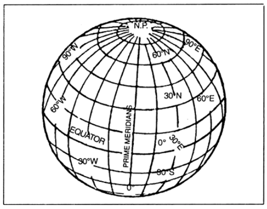
The network of Parallels and Meridians
The links joining north pole and south pole are called meridians of longitude. The meridian passing through Greenwich is known as Prime Meridian. There are 180 meridians towards the east and west of the prime meridian. Thus, there are 360 meridians in all.


Some More Questions From Map Projections Chapter
What is the demerit of cylindrical projection ?
Describe the elements of map projection.
What do you mean by global property?
How does a map differ from a globe?
Why is it necessary to know about map projection ?
What facts need to be kept in view while transferring the globe on a plain surface ?
Which are important geographical relationships that one looks for in a map ?
Explain the differences between Parallels and Meridians.
Explain the differences between Map and Map Projection.
Distinguish between developable and non-developable surface.
Sponsor Area
Mock Test Series
Mock Test Series