

Question
Describe the various weather symbols used in weather maps.
Solution
Weather elements are shown on the weather maps with the help of some symbols.
These are internationally recognized and are called weather symbols. Different weather phenomena can be identified with the help of these symbols.
1. Pressure: Isobars are used to show the atmospheric pressure of a place.
2. Temperature: Isotherms are used to show the temperature of a place.
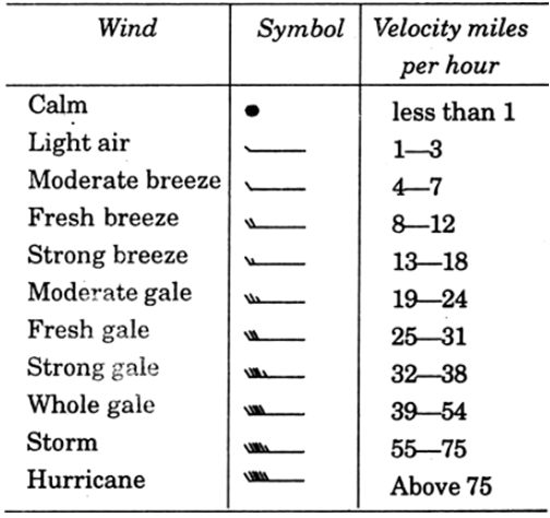
3. Winds: Wind velocity and direction is shown by arrows. The system was devised by Admiral Beaufort in 1806 and is known as Beaufort Scale.
4. Clouds: Circles used to show the nature and amount of cloudiness.
5. Rainfall : Certain symbols and letters are used to show rainfall and other atmospheric phenomena.


